
Everest Region (Khumbu), Nepal
Mera Peak with Everest Base Camp
Eighteen days up the remote Hinku valley to the summit of Mera Peak at 6,476 m, then over the technical Amphu Laptsa pass into the Khumbu and on to Everest Base Camp — an expedition rather than a trek.
Package Overview
Best Time to Visit
April to May, October to November
Guided & Permitted
Licensed, insured guide and all trekking permits included
The honest description of this trip
This is a mountaineering expedition. It is sold across the internet as a trek with a climb attached, and that description is misleading enough to be worth correcting in the first paragraph.
The summit of Mera Peak at 6,476 m is, by 6,000 m standards, technically straightforward — a long snow slope with a short steep step near the top. The hard part of this itinerary is not the peak. It is Amphu Laptsa at 5,845 m, the pass that links the Hinku valley to the Khumbu, and it is a technical crossing involving steep snow and ice, fixed ropes and abseiling with a serious drop beneath you.
If you want Mera Peak, we can take you up it and back down the way you came in around sixteen days. If you want Mera Peak and Everest Base Camp in one continuous journey, Amphu Laptsa is the only way to link them, and this page is about that trip.
Why Mera, and what you see from the top
Mera is the highest peak in Nepal that can be climbed on a trekking permit rather than an expedition permit. That makes it the highest summit most people will ever reach, and the view is the reason it is worth reaching.
From the top, on a clear morning, five of the world's fourteen eight-thousanders are visible: Everest, Lhotse, Cho Oyu, Makalu and Kanchenjunga. There is nowhere else in Nepal at a non-technical altitude that offers that.
The approach is the other attraction. The Hinku valley is separated from Khumbu by the Zatrwa La and sees a tiny fraction of the traffic — no bakeries, no wifi worth the name, and days when you will see nobody. After two weeks of that, walking into Namche on the way out is genuinely disorienting.
Amphu Laptsa: read this before you book
We are going to be specific, because this is the crux and most pages gloss it.
| What it involves | What that means for you |
|---|---|
| Steep snow and ice on both sides | Crampons, ice axe and rope from before dawn |
| Fixed rope and abseil on the Khumbu descent | You must be able to abseil confidently, in the dark, tired |
| No escape route once committed | There is no path down from the pass except over it |
| Eight to nine hours on the crossing day | At altitudes above 5,500 m throughout |
| Weather-dependent | Heavy snow can close it outright |
If the pass is closed when we get there, the alternative is to retreat down the Hinku and fly out from Lukla, which means no Everest Base Camp. We build a contingency day in, we watch the forecast, and we will not cross it in bad conditions. You should book this trip understanding that outcome is possible.
Anyone who is not confident on an abseil should either train before coming or book Island Peak with Everest Base Camp, which reaches a 6,189 m summit with no pass crossing and no committed ground.
What you need to bring to this, personally
This is the one trip we run where we will decline a booking on experience grounds.
- Previous experience above 5,000 m is expected. This is not a first Himalayan trip.
- Prior use of crampons, ice axe and rope, whether on a course or a previous climb. We teach and refresh, but we are not teaching from zero on this itinerary.
- Genuine hill fitness: eighteen days, two nights above 5,700 m, and a 6,476 m summit day.
- Comfort with commitment: from Khare to the Khumbu there is no road, no helicopter landing site you can walk to easily, and no way around the pass.
Tell us honestly what you have done. We would much rather move you to a different trip at the enquiry stage than have the conversation at 5,800 m.
The altitude plan
Eighteen days is long, and almost all of the extra length over a standard Everest Base Camp trek is acclimatisation rather than distance.
The route crosses the Zatrwa La (4,610 m) early, which is a useful high point in the first week. It then climbs the Hinku gradually to Khare (5,045 m), where a rest and skills day sits before the peak. Summit day runs from a high camp at around 5,780 m.
After the summit the route does not descend far, because Amphu Laptsa is still to come — which means several consecutive nights above 5,000 m. This is the most sustained time at altitude of any trip we sell, and it is why the experience requirement above is not negotiable.
One thing this eighteen-day version does not carry is a summit contingency day. The longer itinerary held a spare day at Khare so that a bad-weather morning on Mera meant trying again the next day. Here it means not summiting. Everything protecting you from altitude is still in place — the Zatrwa La, the Khare rest and skills day, the gradual climb up the Hinku — but the weather margin is not. If a second attempt matters more to you than three days, ask us and we will run the longer version.
Crew, and why the group is small
We cap this trip at six clients. Amphu Laptsa requires fixing rope and managing an abseil for every member of the party, and beyond six that becomes slow enough to be a safety problem in its own right — a party strung out on a pass in deteriorating weather is the situation to avoid.
You travel with a certified climbing guide, climbing sherpas in proportion to group size, a cook and kitchen crew for the tented sections, and porters. On summit day and on the pass the ratio is close to one to one.
Permits — five of them
- NMA climbing permit for Mera Peak, seasonal fee
- Makalu Barun National Park entry permit, for the Hinku valley
- Sagarmatha National Park entry permit, for the Khumbu side
- Khumbu Pasang Lhamu rural municipality fee
- TIMS card
The trip crosses between two national parks, which is why there are two park permits rather than one. All are included.
Season
April to May and October to November only, and this trip is more weather-sensitive than the others because of the pass. Spring usually gives better snow conditions on Amphu Laptsa; autumn gives clearer summit views from Mera.
We will not run it outside those windows. A technical pass at 5,845 m in winter or monsoon conditions is not a trekking proposition and no price makes it a reasonable one.
Where this trek goes
- Kathmandu Valley — Seven UNESCO Monument Zones within an hour of each other
Related activities: Peak Climbing in Nepal, Mountaineering Expeditions.
Or compare every trip we run: all trekking and tour packages.
Trip Highlights
Mera Peak (6,476 m), the highest of Nepal's designated trekking peaks
Five 8,000 m summits visible from the top: Everest, Lhotse, Cho Oyu, Makalu, Kanchenjunga
Amphu Laptsa (5,845 m) — a genuinely technical pass crossing
The Hinku valley, remote and almost empty compared to Khumbu
Everest Base Camp and Kala Patthar on the way out
Two 6,000 m nights and a full expedition crew
Live Weather
Detailed Itinerary
1
Day 1: Fly to Lukla (2,840 m), trek to Chutanga (3,050 m)
A morning flight into Lukla, or out of Ramechhap in peak season after a drive before dawn, then three to four hours climbing east away from the Everest trail into forest. The crowds are gone within the first hour — almost nobody walks this way. Chutanga is a clearing with a few huts rather than a village. Climbing kit is checked here tonight, which is how this version does without a day in Kathmandu.
2
Day 2: Chutanga to Thuli Kharka (4,300 m) over the Zatrwa La (4,610 m)
Six to seven hours and a serious first full day: 1,560 m of ascent to the Zatrwa La, a rocky notch strung with prayer flags, then a descent to Thuli Kharka on the far side. Going this high on day two is deliberate rather than careless — it is a climb-high-sleep-low day built into the walk-in, and the Hinku valley opens ahead of you from the top with Mera itself still hidden behind its own ridges.
3
Day 3: Thuli Kharka to Kothe (3,600 m)
Five to six hours losing 700 m into the Hinku valley through rhododendron and birch, following the river south. A descending day after a hard one, and the vegetation thickens as you drop. Kothe sits on the west bank among trees, and the walking from here is upstream for the next three days.
4
Day 4: Kothe to Thangnak (4,350 m)
Four to five hours up the Hinku, past the small gompa at Gondishung built under a boulder — worth the ten minutes — and out of the treeline for the last time. Thangnak is a summer grazing settlement rather than a permanent village, a handful of stone huts and lodges on open ground with Mera’s north face finally in view ahead.
5
Day 5: Thangnak to Khare (5,045 m)
Three to four hours and only 700 m, taken slowly because 5,045 m is a serious place to sleep. The trail climbs beside the Dig Glacier’s moraine with Charpate Himal to the east. Khare is the last settlement before the mountain, a cluster of lodges below the glacier, and from the terrace you can trace the whole of tomorrow’s route with your eye.
6
Day 6: Khare — acclimatisation and climbing skills day
Not negotiable and not cut. The morning is spent on the glacier below the peak working with crampons, axe, harness, rope and abseil until it is automatic rather than remembered. The afternoon is rest at 5,045 m. This is the only full acclimatisation day on the trip and everything after it depends on the body having used it.
7
Day 7: Khare to Mera High Camp (about 5,780 m)
Four to five hours, roped from the point the glacier begins, climbing to a camp on rock ledges beside the ice at around 5,780 m. Short in distance and slow in the air. The view east from the tents takes in Makalu and Kanchenjunga and is among the best on any trip we run. Sleeping here is hard, nobody sleeps well, and it is still the right call — summit day from Khare would be unmanageable.
8
Day 8: Summit Mera Peak (6,476 m), descend to Khare
Away around two in the morning for eight to ten hours round trip. A long, steady glacier plod at a gentle angle — Mera is technically the easiest of the Khumbu climbing peaks and the difficulty is entirely altitude and duration. A short steep step of fixed rope guards the true summit, and from it Everest, Lhotse, Makalu, Cho Oyu and Kanchenjunga stand round the horizon. Then all the way down to Khare.
9
Day 9: Khare to Kongma Dingma (4,850 m)
Four to five hours north-west on little-used ground, leaving the Hinku for the valley that leads towards the pass. This is the quietest section of an already quiet route and you are unlikely to see another party. Kongma Dingma is a grazing area with summer huts and no permanent habitation at all.
10
Day 10: Kongma Dingma to Seto Pokhari (5,035 m)
Five to six hours climbing beside glacial lakes into increasingly bare country, with Chamlang’s wall to the north. Seto Pokhari — "white lake" — is a tented camp beside the water at 5,035 m. From here on there are no lodges and no villages until Chhukung on the far side of the pass; everything is carried.
11
Day 11: Seto Pokhari to Amphu Laptsa Base Camp (5,400 m)
Four to five hours over moraine to a camp directly below the pass, with the wall you cross tomorrow standing above the tents. A short day on purpose: the crew goes ahead to assess the route and fix what needs fixing, and you rest, eat early and sleep as well as 5,400 m allows. The guide gives the weather call tonight.
12
Day 12: Cross the Amphu Laptsa (5,845 m) to Chhukung (4,730 m)
The crux of the whole trip, and the reason for the experience requirement. An alpine start for a steep snow and ice climb to the notch at 5,845 m, roped throughout. The north side is the serious part — a fixed-rope abseil down a steep wall onto the glacier below, done one at a time, which is why the group is capped at six. Then a long descent on moraine into the Imja valley and down to the lodges at Chhukung. Ten to twelve hours, and the first bed in four nights.
13
Day 13: Chhukung to Lobuche (4,940 m)
Seven to eight hours down the Imja valley through Dingboche and up the Khumbu past Thukla and its memorial ridge. A long day, and the one that was two days on the twenty-one-day version. It works here because you have already slept at 5,400 m and crossed 5,845 m — Lobuche is well below ground your body has handled, so this is a question of legs rather than lungs.
14
Day 14: Lobuche to Everest Base Camp (5,364 m), night at Gorak Shep (5,170 m)
Six to seven hours in total over broken moraine beside the Khumbu Glacier to Gorak Shep, then out to Base Camp and back. After Amphu Laptsa this is an easy day in every respect except the altitude. Everest is not visible from Base Camp; the Icefall is, and having arrived by the route you took, it reads differently.
15
Day 15: Kala Patthar (5,545 m), descend to Pheriche (4,240 m)
Before dawn up Kala Patthar for Everest’s south-west face in first light — the highest you stand on foot after the summit, and the last of the big views. Then a long descent of more than 1,300 m to Pheriche. The air thickens hour by hour and the relief is physical.
16
Day 16: Pheriche to Namche Bazaar (3,440 m)
Six to seven hours down through Pangboche and Tengboche, with the climb out of Phunki Thenga as the last real effort of the trip. Trees again, then Namche, which after two and a half weeks in the Hinku and the upper Khumbu feels like a capital city. Hot shower, a bakery, and a beer that is finally a good idea.
17
Day 17: Namche Bazaar to Lukla (2,840 m)
Six to seven hours retracing the valley down the Dudh Koshi and across the suspension bridges, with the final climb into Lukla as a parting insult. Last night on the trail, and the one where the climbing crew get bought a drink — on this route they have earned it more than on any other trip we run.
18
Day 18: Fly Lukla to Kathmandu
A morning flight out, weather permitting. Flights run early because the wind builds through the day, and if Lukla is closed we hold and talk through a helicopter transfer at cost. This version carries no spare day at the end, so leave genuine slack between landing and your international flight.
Cost Details
What's Included
- Return flights, Kathmandu to Lukla
- NMA climbing permit for Mera Peak
- Makalu Barun and Sagarmatha National Park permits, municipality fee and TIMS card
- All accommodation: basic lodges in the Hinku, tented camps, lodges in Khumbu
- Full expedition crew: climbing guide, climbing sherpas, cook, kitchen crew and porters
- Breakfast, lunch and dinner throughout
- Climbing skills and abseil training day at Khare
- All group climbing equipment: ropes, ice screws, snow bars, fixed lines for the pass
- Personal climbing hardware on request: harness, helmet, jumar, ice axe, crampons
- Close to one-to-one guiding on summit day and on Amphu Laptsa
- Crew wages, insurance, equipment, food and accommodation
- First aid kit, pulse oximeter and emergency oxygen
- One contingency day for the summit and one spare day in Kathmandu
- Government taxes and company service charge
What's Not Included
- International flights and Nepal visa
- Travel insurance — must cover peak climbing to 6,500 m and helicopter evacuation
- Accommodation and meals in Kathmandu beyond arrival night
- Mountaineering boots, down jacket and sleeping bag rated to -30°C
- Hot showers, charging and bottled drinks where available
- Summit bonus for the climbing guide and sherpas, which is customary
- Tips for the crew
- Any cost arising from a closed pass, aborted summit, early descent or evacuation
Essential Information
- Maximum altitude: 6,476 m
- Trip duration: 18 days
- Difficulty: expert
- Best season: April to May, October to November
- Group size: 2 to 6 trekkers
- Permits: NMA climbing permit for Mera Peak; Makalu Barun National Park entry permit for the Hinku valley; Sagarmatha National Park entry permit; Khumbu Pasang Lhamu rural municipality fee; TIMS card — all included and arranged by us
- Accommodation: Basic lodges in the Hinku valley, tented high camps, lodges in Khumbu
- Guide: licensed and insured, English speaking
- Weather reference point: Khare
Important Cost Information
Payment Terms:
- • 25% deposit required to confirm booking
- • Balance payment due 30 days before departure
- • Full refund if cancelled 45+ days before
Fixed Departure Dates
Choose from our scheduled group departures with guaranteed departures.
Route Map
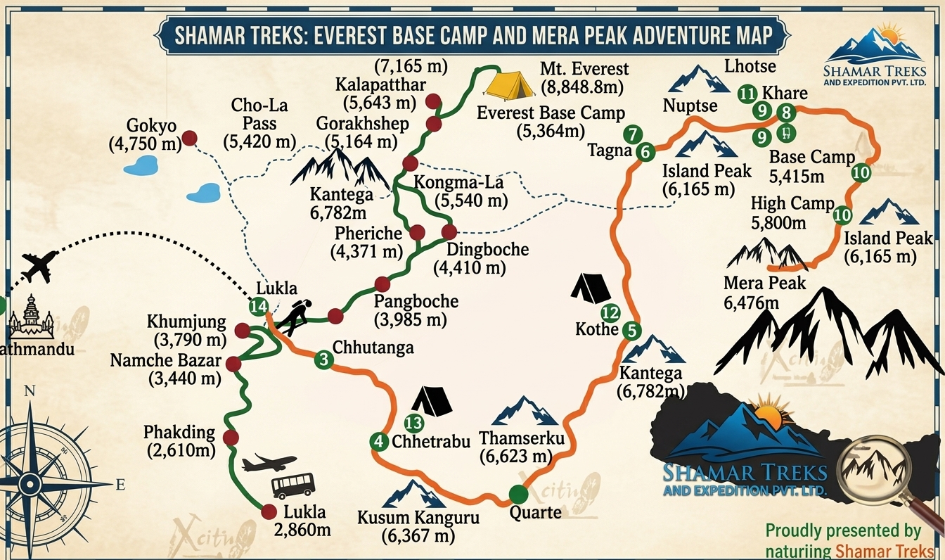
Route map image could not be loaded
Showing route for Mera Peak with Everest Base Camp
Route Information
Starting Point:Lukla
Ending Point:Lukla
Highest Point:Mera Peak (6,476 m)
Key Locations
Lukla
Day 1
start
2,840 m
Zatrwa La
Day 2
landmark
4,610 m
Kothe
Day 3
3,600 m
Khare
Day 5
5,045 m
Mera High Camp
Day 7
5,780 m
Mera Peak summit
Day 8
landmark
6,476 m
Seto Pokhari
Day 10
5,035 m
Amphu Laptsa
Day 12
landmark
5,845 m
Everest Base Camp
Day 14
landmark
5,364 m
Kala Patthar
Day 15
landmark
5,545 m
Frequently Asked Questions
Mera Peak is 6,476 m, the highest of Nepal's designated trekking peaks. High camp is at around 5,780 m. The other high point of this itinerary is Amphu Laptsa pass at 5,845 m, and on the Khumbu side you also reach Kala Patthar at 5,545 m.
Still have questions?
Our travel experts are here to help you plan the perfect trip. Get in touch with us for personalized advice.
Reviews & Ratings
—
0 reviews
5★
0
4★
0
3★
0
2★
0
1★
0
Share Your Experience
Have you completed this trek? Help other travelers by sharing your experience.